TerraChange Land-use Model
Using statistical models to predict land-use change and spatially explicit baselines.
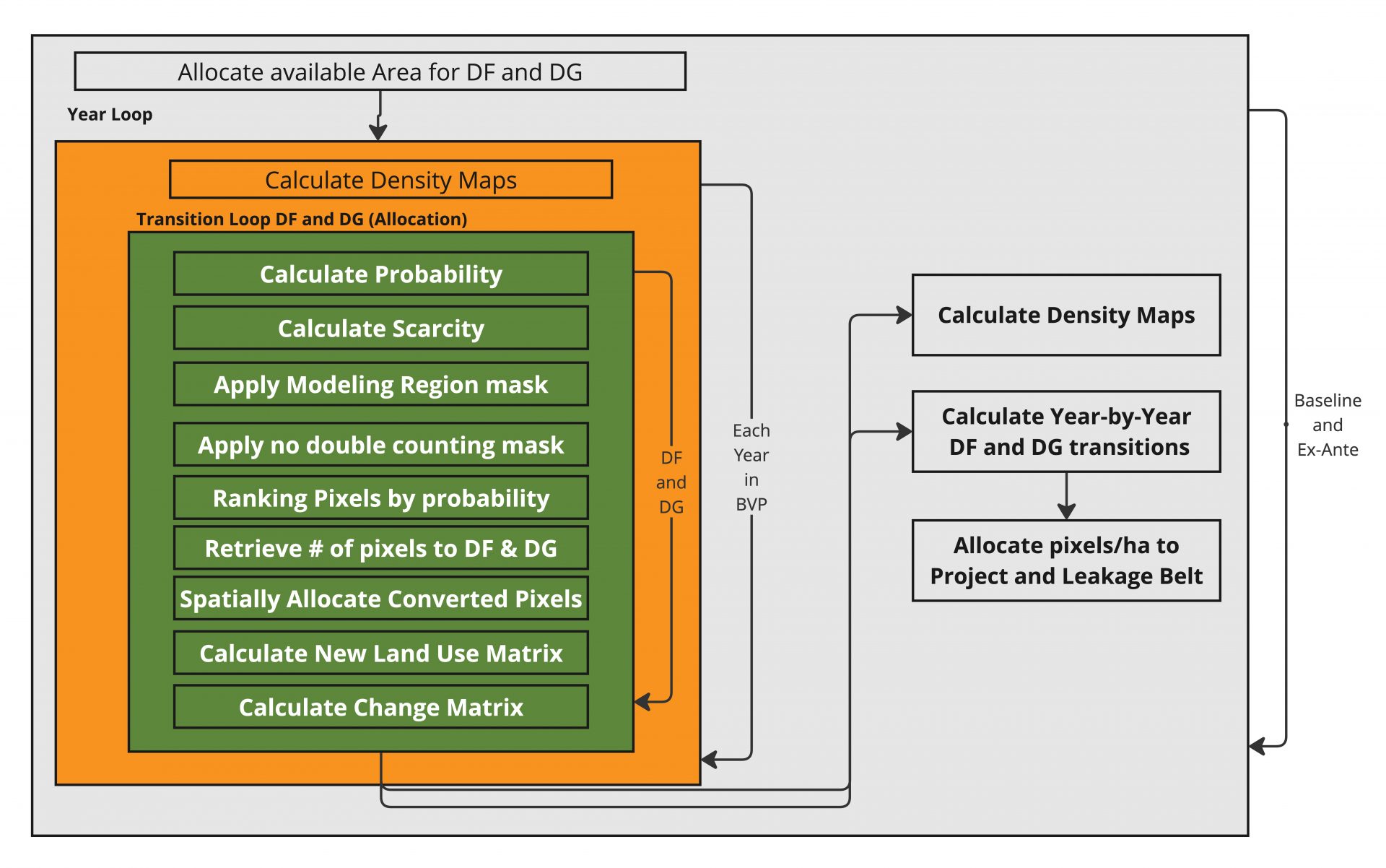
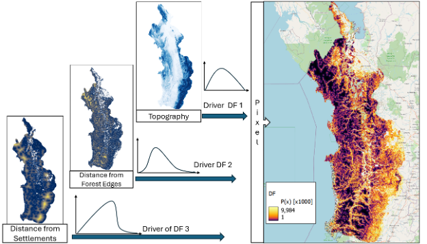
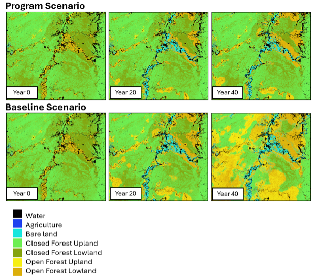
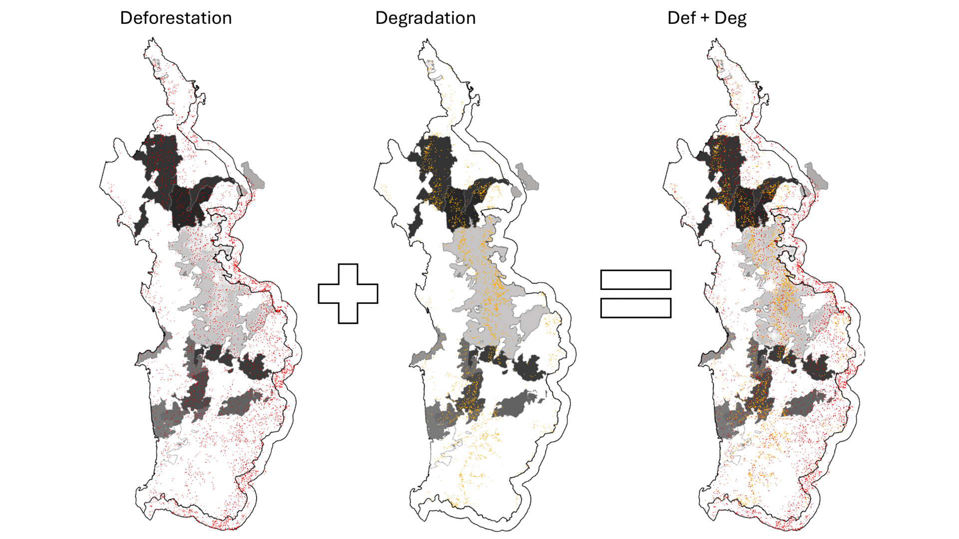
The TerraChange Land-Use Model is a predictive tool that enables jurisdiction-wide and program-level land-use forecasting. By integrating empirical data, statistical modeling, and spatially explicit predictions, TerraChange helps assess deforestation and degradation risks, reforestation potential, and GHG emissions with scientific accuracy.
-
Spatially Accurate Forecasting: Uses advanced statistical models to map and predict deforestation, reforestation, degradation, and enhancement over time
-
Large-Scale Risk Modeling: Evaluates deforestation and degradation drivers across jurisdictions to support conservation and land management planning
-
Scenario-Based Decision-Making: Programs GHG emissions under multiple land-use scenarios, helping policymakers assess potential outcomes
-
Verification Alignment: Produces methodologically sound outputs that meet third-party verification and carbon accounting standards