TerraCover
Proprietary models that deliver accurate land-use classifications.
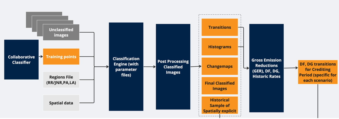
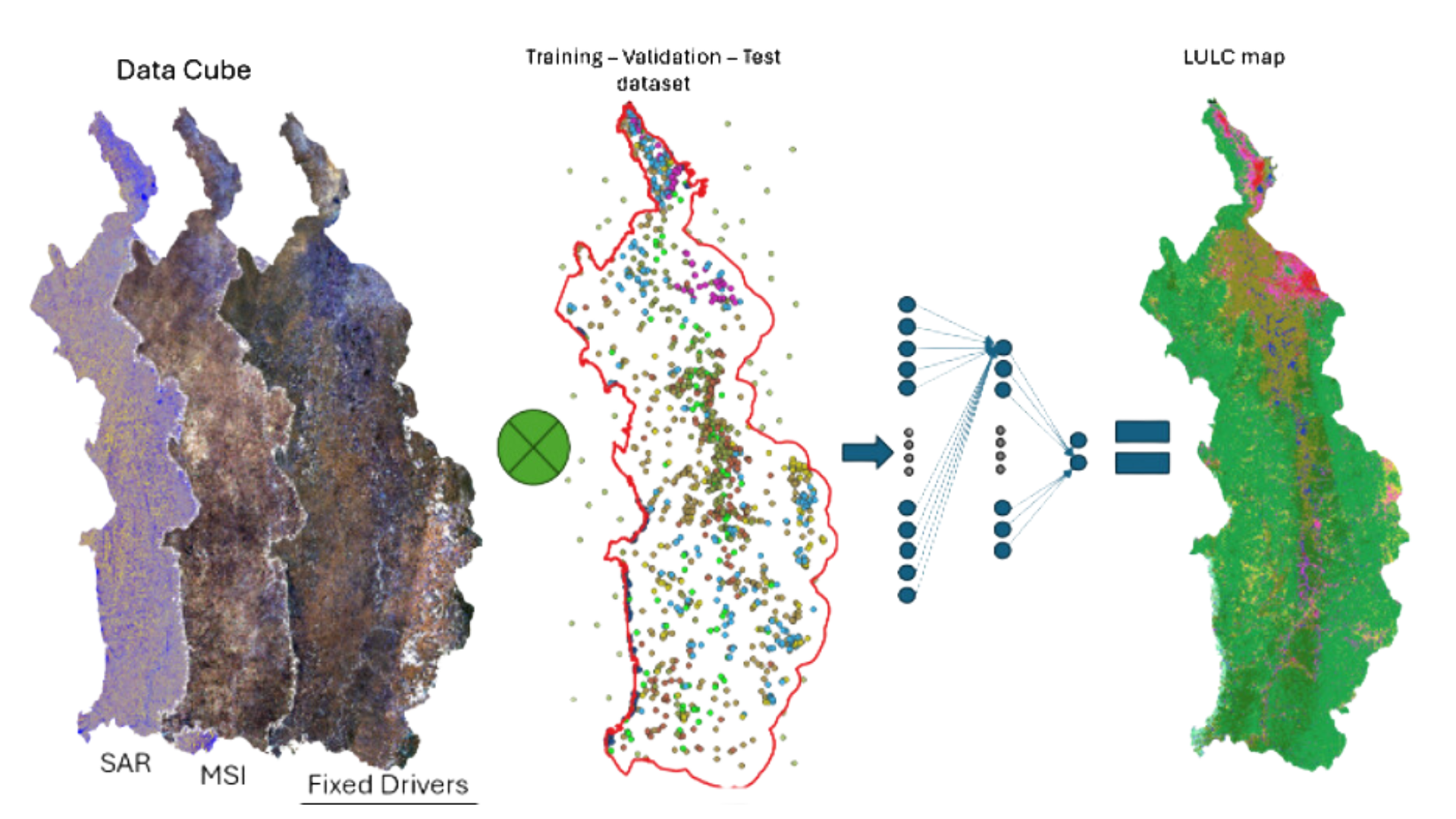
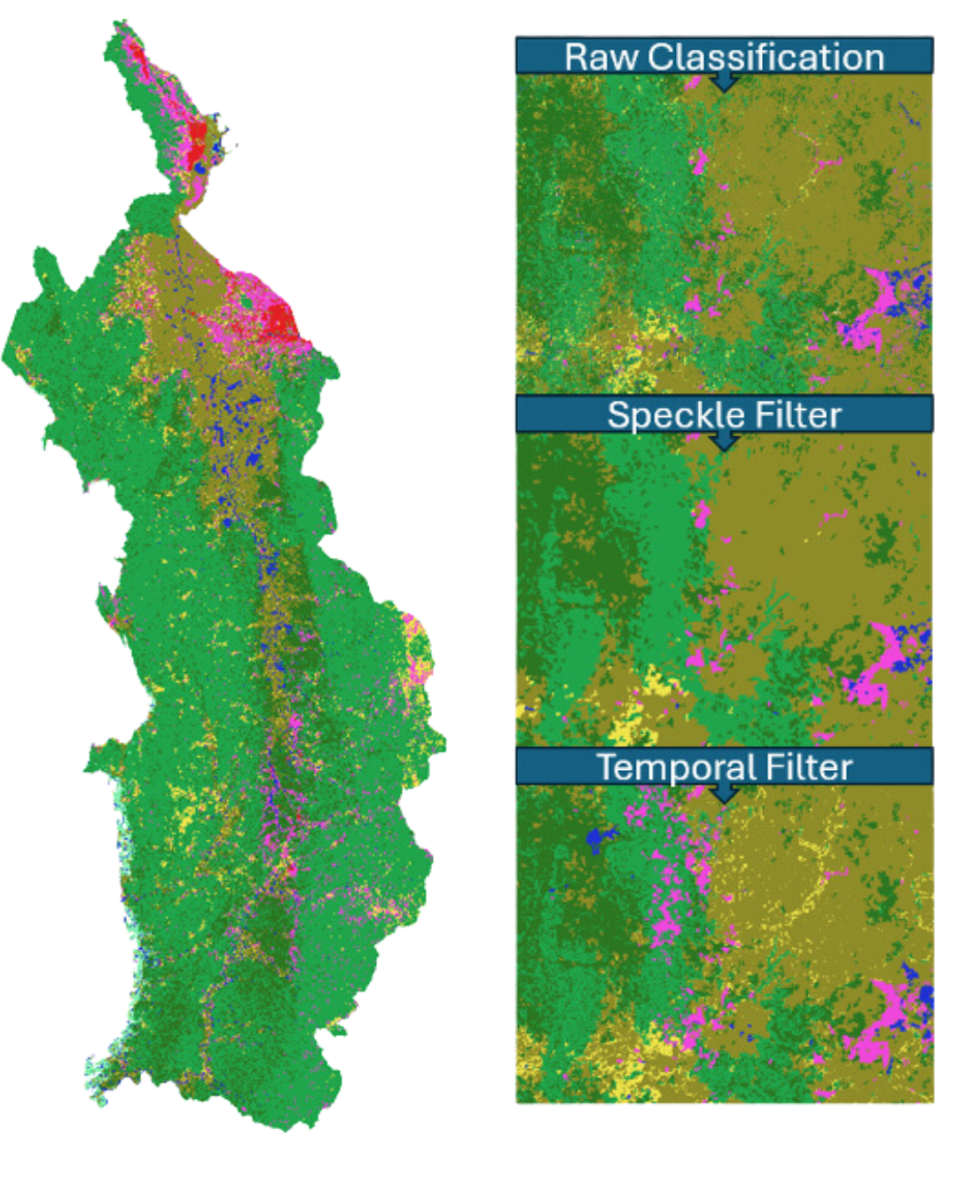
TerraCover is a land-use and land-cover (LULC) classification tool designed to support accurate and consistent mapping of land-use changes to mitigate environmental changes. It enables users to interpret satellite imagery, classify ground cover types, and validate classifications using expert input and machine learning algorithms.
-
Accurate Classification: Enables high-accuracy LULC classification using expert-driven methodologies
-
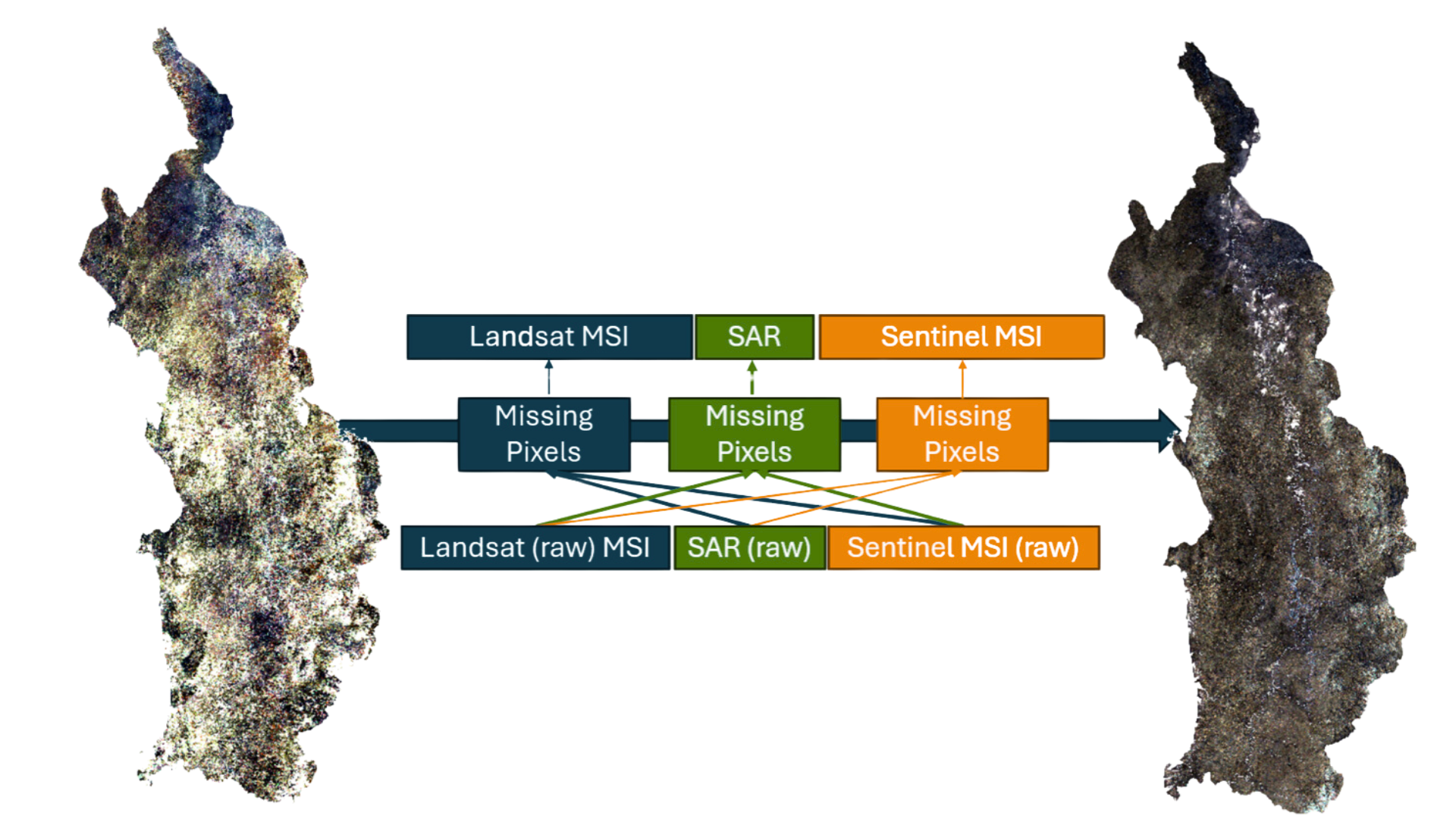
Multi-Sensor Analysis: Leverages different remote sensing sources (MSI, LiDAR, and SAR) to enhance classification precision
-
Collaborative Validation: Allows user-driven classification and validation through sample-based visual outputs for continuous improvement
-
Scalable Mapping: Facilitates large-scale land cover mapping to support conservation and planning efforts