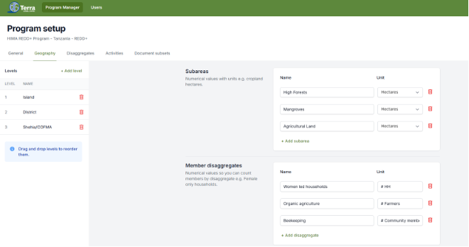
Nested Program Manager
Organizes program activities into nested geographical units such as zones, districts, and provinces to support scalable management of environmental and land use interventions.


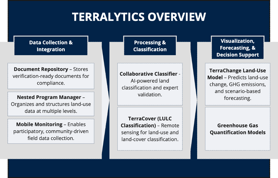
Terralytics is designed to empower communities to manage their landscapes and support governments in providing transparent systems.
Terralytics offers a cost-effective and locally relevant approach to managing multi-scale information for sustainable land-use activities that generate verifiable environmental services.
Organizes program activities into nested geographical units such as zones, districts, and provinces to support scalable management of environmental and land use interventions.
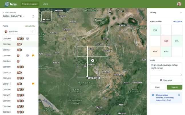
Strengthens land classification by integrating local expert knowledge, AI-driven analysis, and uncertainty assessment to improve accuracy and reliability.
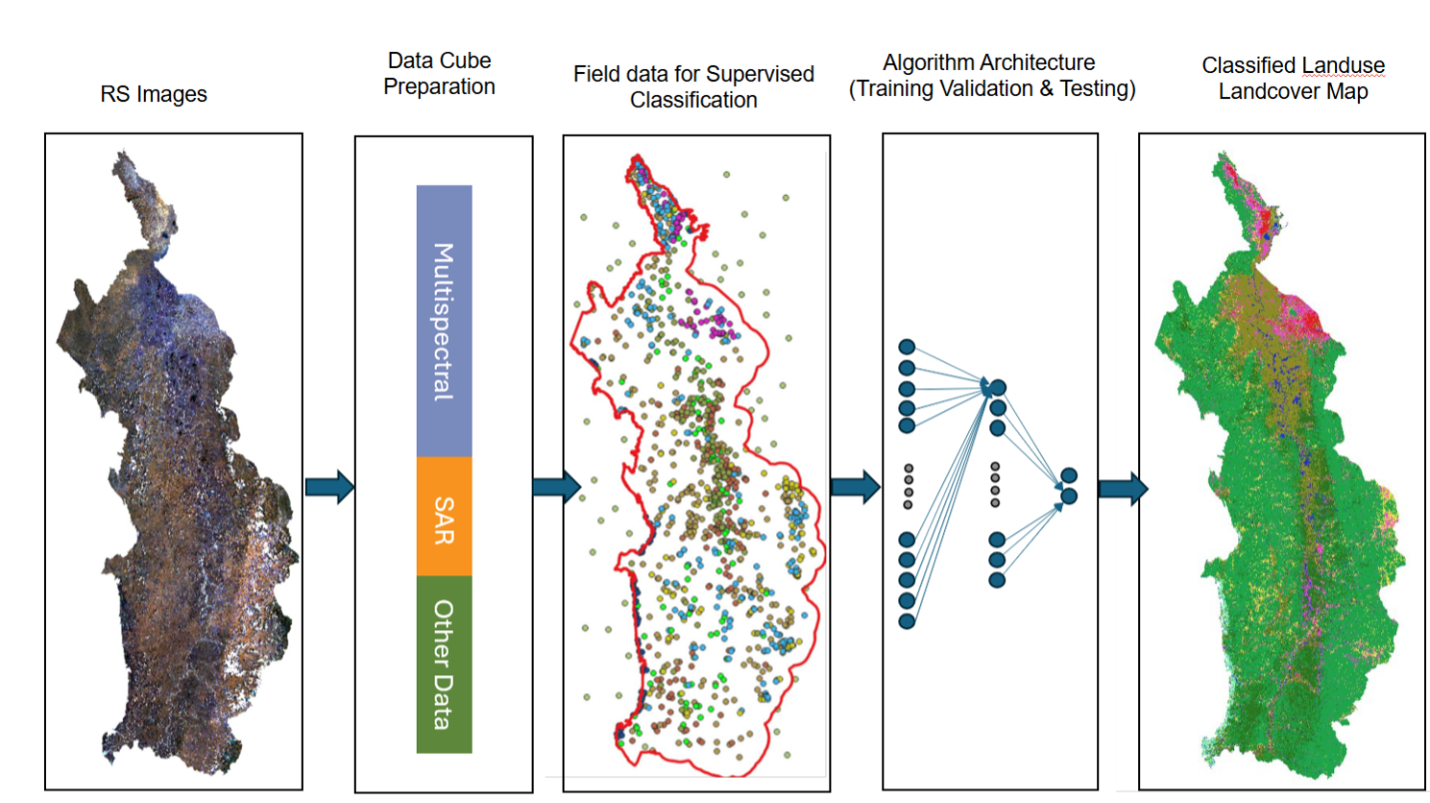
Enables users to interpret satellite imagery, classify ground cover types, and validate classifications using expert input and machine learning algorithms.
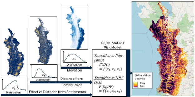
Predictive tool that enables jurisdiction-wide and program-level land-use forecasting by integrating empirical data, statistical modeling, and spatially explicit predictions.
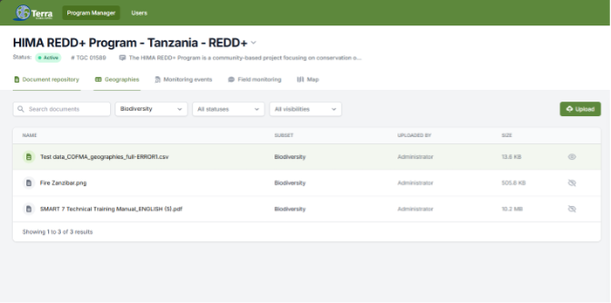
Supports validation and verification of programs by providing secure access to all necessary documentation, including confidential materials, in a controlled data room.
